MapBiomas Indonesia | Fire, commonly known as MapBiomas Fire, is one of MapBiomas Indonesia's products and initiatives. Previously, MapBiomas Indonesia produced a map of Indonesia's land cover dynamics, also known as Landy. MapBiomas Indonesia is also developing MapBiomas Alerta, which will identify and report deforestation in near real-time.
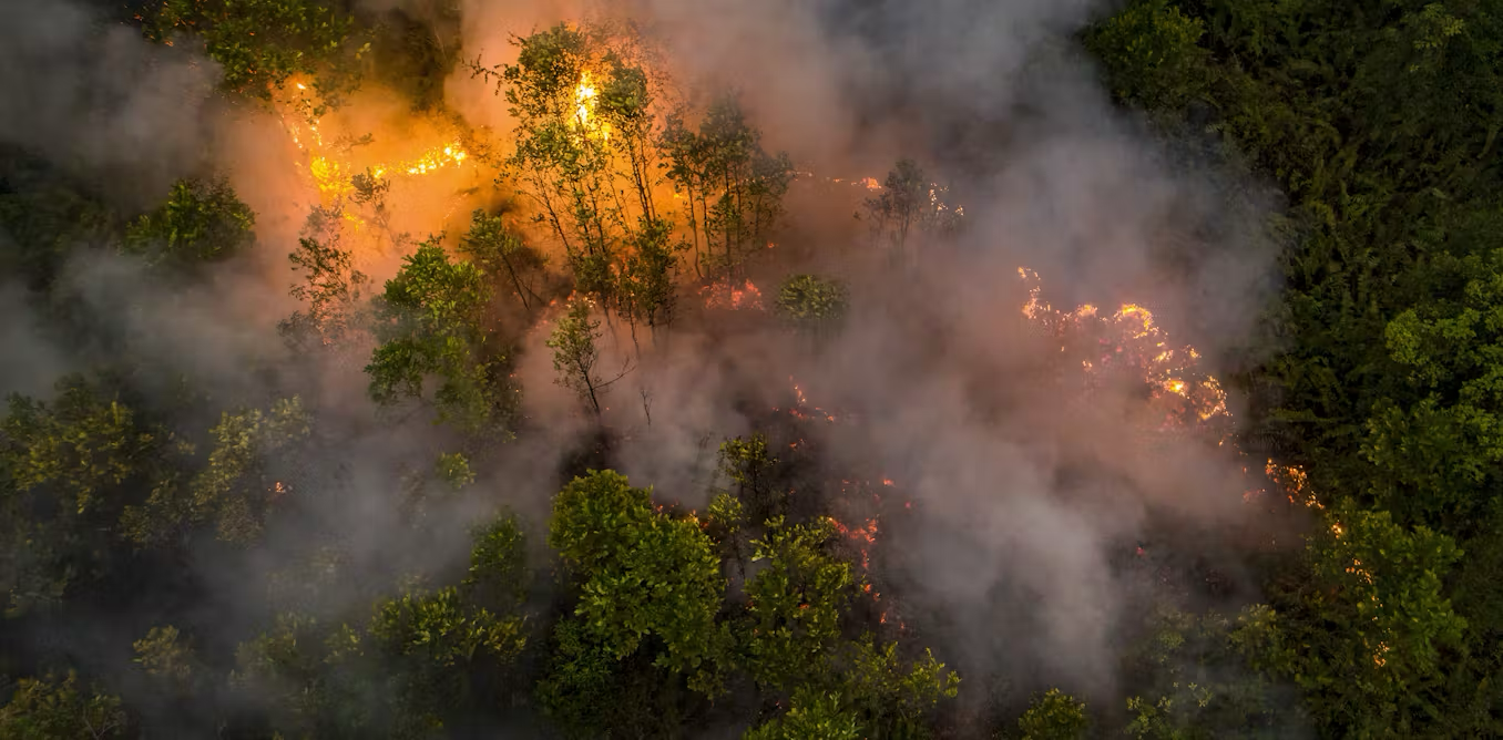
MapBiomas Fire maps burned land in Indonesia, which is generated through the use of computing technology supported by machine learning and deep learning algorithms on satellite imagery.
The current MapBiomas Fire land fire map, available as Collection 2.0, displays annual land fire maps for the years 2000 to 2024. In the future, in addition to adding annual burned land maps for future years, MapBiomas Indonesia also plans to create monthly land fire maps, especially for peak fire months.
MapBiomas Indonesia | Fire, commonly known as MapBiomas Fire, is one of MapBiomas Indonesia's products and initiatives. Previously, MapBiomas Indonesia produced a map of Indonesia's land cover dynamics, also known as Landy. MapBiomas Indonesia is also developing MapBiomas Alerta, which will identify and report deforestation in near real-time.
MapBiomas Fire maps burned land in Indonesia, which is generated through the use of computing technology supported by machine learning and deep learning algorithms on satellite imagery.
The current MapBiomas Fire land fire map, available as Collection 2.0, displays annual land fire maps for the years 2000 to 2024. In the future, in addition to adding annual burned land maps for future years, MapBiomas Indonesia also plans to create monthly land fire maps, especially for peak fire months.
MapBiomas Indonesia Fire is part of the MapBiomas Indonesia initiative, which was built by a network of civil society organizations in various regions of Indonesia, namely:
HAKA Aceh
HAKi South Sumatra
GENESIS Bengkulu
SAMPAN West Kalimantan
SAVE OUR BORNEO Central Kalimantan
GREEN OF BORNEO North Kalimantan
KOMIU Central Sulawesi
MNUKWAR West Papua
JERAT Papua
MapBiomas Indonesia is supported by Woods & Wayside International.
MapBiomas Fire is produced and updated regularly. The X.Y Collection naming is used to denote the data release version, where:
Collection 2.0 is an update of the previous release, with expanded fire data coverage to cover the period 2000–2024, as well as improvements to data quality and consistency.
Collection 2.0 presents data/maps of burned land in Indonesia from 2000 to 2024. The data and/or maps are in the form of:
All data is also available based on land cover and land use classes from MapBiomas Indonesia Landy 4.0.
Collection 2.0 presents data/maps of burned land in Indonesia from 2000 to 2024. The data and/or maps are in the form of:
All data is also available based on land cover and land use classes from MapBiomas Indonesia Landy 4.0.
The current 2.0 collection only covers data going back to 2000. Therefore, MapBiomas Fire plans to go back further, at least to 1990, to obtain more comprehensive yet in-depth information on Indonesia's burned land.
In addition to going back at least to 1990, MapBiomas Fire also plans to update the data according to the current year through subsequent collections.
The availability of various publicly accessible satellite imagery represents a potential opportunity worthy of study and/or further exploration. For example, by analyzing Sentinel satellite imagery, MapBiomas Indonesia | FIRE plans to release monthly burned land data for the current year, as MapBiomas Brazil | FIRE currently does.
In line with scientific standards, MapBiomas Fire also plans to conduct accuracy tests on future collections.
Mapbiomas Fire products can be accessed in three ways:
Burned area by island, province, regency/municipality, subdistrict, village, and specified geometric can be downloaded according to the toolkit available in the Google Earth Engine. This makes it easier to export maps in raster formats; and provides statistical data on geometrics and periods in CSV format. Data descriptions are provided in the legend code.
Accessed though data assets in the Google Earth Engine, as follow:
Annual burned area, at: projects/mapbiomas-public/assets/indonesia/fire/collection2/mapbiomas_indonesia_fire_collection2_annual_burned_coverage_v1
Annual burned area by land cover class in Landy 4.0, at: projects/mapbiomas-public/assets/indonesia/fire/collection2/mapbiomas_indonesia_fire_collection2_annual_burned_coverage_v1
Monthly burned area, at: projects/mapbiomas-public/assets/indonesia/fire/collection2/mapbiomas_indonesia_fire_collection2_monthly_burned_v1
Accumulated burned area, at: projects/mapbiomas-public/assets/indonesia/fire/collection2/mapbiomas_indonesia_fire_collection2_accumulated_burned_v1
Accumulated burned area by land cover class in Landy 4.0, at: projects/mapbiomas-public/assets/indonesia/fire/collection2/mapbiomas_indonesia_fire_collection2_accumulated_burned_coverage_v1
Fire frequency, at: projects/mapbiomas-public/assets/indonesia/fire/collection2/mapbiomas_indonesia_fire_collection2_fire_frequency_v1
Maps in GeoTiff format (one map per year) can be downloaded directly through the following links:
Note: Users can adjust the year in the download link to download data for a selected year.
Annual burned area (2024): https://storage.googleapis.com/shared-development-storage/COLLECTIONS/INDONESIA/FIRE/COLLECTION2/mapbiomas_indonesia_fire_collection2_annual_burned_v1/burned_area_2024.tif
Annual burned area by land cover class in Landy 4.0 (2024): https://storage.googleapis.com/shared-development-storage/COLLECTIONS/INDONESIA/FIRE/COLLECTION2/mapbiomas_indonesia_fire_collection2_annual_burned_coverage_v1/burned_coverage_2024.tif
Monthly burned area (2024): https://storage.googleapis.com/shared-development-storage/COLLECTIONS/INDONESIA/FIRE/COLLECTION2/mapbiomas_indonesia_fire_collection2_monthly_burned_v1/burned_monthly_2024.tif
Accumulated burned area (2000-2024): https://storage.googleapis.com/shared-development-storage/COLLECTIONS/INDONESIA/FIRE/COLLECTION2/mapbiomas_indonesia_fire_collection2_accumulated_burned_coverage_v1/fire_accumulated_2000_2024.tif
Accumulated burned area by land cover class in Landy 4.0 (2000-2024): https://storage.googleapis.com/shared-development-storage/COLLECTIONS/INDONESIA/FIRE/COLLECTION2/mapbiomas_indonesia_fire_collection2_accumulated_burned_coverage_v1/fire_accumulated_2000_2024.tif
Fire frequency (2000-2024): https://storage.googleapis.com/shared-development-storage/COLLECTIONS/INDONESIA/FIRE/COLLECTION2/mapbiomas_indonesia_fire_collection2_frequency_burned_v1/fire_frequency_2000_2024.tif
We have already compared Mapbiomas Fire data with similar datasets we were able to access. Comparisons are necessary to look at agreement or disagreement between these datasets, along with their causes.
As far as we know, mapping of burned areas in Indonesia can be differentiated between (1) international initiatives, or Indonesian ones becoming part of such initiatives; and (2) existing initiatives in and/or focusing on Indonesia. Initiatives under the former category consist of MODIS (MCD64A1), Fire CCI, and Global Annual Burned Area Mapping (GABAM); whereas initiatives under the latter category before now have only been conducted or produced by the Ministry of Environment and Forestry (KLHK).
Below is a comparison between Mapbiomas Fire data and other similar datasets:
The MapBiomas Indonesia Fire platform doesn't offer vector maps because vectorizing maps across the entire area isn't practical. The recommended solution for working with vectors is to download the data, clip the area you're interested in, and then create a vector using your preferred software.
The MapBiomas Indonesia Fire platform doesn't offer vector maps because vectorizing maps across the entire area isn't practical. The recommended solution for working with vectors is to download the data, clip the area you're interested in, and then create a vector using your preferred software.
Yes, MapBiomas Indonesia Fire data is open to the public and can be accessed free of charge for non-commercial users or for public interest purposes.
Yes, MapBiomas Indonesia Fire data is open to the public and can be accessed free of charge for non-commercial users or for public interest purposes.
Yes, the MapBiomas Indonesia Collection is available as an asset on the Google Earth Engine platform and can be accessed, processed, and analyzed directly on the platform without the need to download the data. Available map collections include:
Yes, the MapBiomas Indonesia Collection is available as an asset on the Google Earth Engine platform and can be accessed, processed, and analyzed directly on the platform without the need to download the data. Available map collections include:
MapBiomas Indonesia Fire data is publicly available and freely accessible under the Creative Commons CC-CY-SA license, subject to its terms of use. Citations of this data should follow the following format:
MapBiomas Indonesia Fire Collection [version] Annual Burned Land in Indonesia 2000-2024, accessed on [DD/MM/YY] via [LINK]